


Ute Mountain rises from the Taos Plateau to her full height of 10,093 feet. Though smaller than nearby peaks, she is foreboding, stand-alone, volcanic, with few rustic trails, no modern conveniences, little signage, and a deep history.
She is well worth a closer look.
Like many, we were curious.
For those who like to bag summits, bushwhack, encounter few “The Ute Mountain 7.5′ quadrangle is located in the south central part of the San Luis Basin of northern New Mexico, in the Rio Grande del Norte National Monument, and contains deposits that record volcanic, tectonic, and associated alluvial and colluvial processes over the past four million years. Ute Mountain has the distinction of being one of the largest intermediate composition eruptive centers of the Taos Plateau, a largely volcanic tableland occupying the southern portion of the San Luis Basin.”
United States Geologic Service (USGS)
The hike-climb to Ute’s summit begins at 7,760 feet and tops out at 10,093. The most convenient car park is located near the Top of the World Farm (see directions box). Hikers should pay close attention to exactly where you park your car, as it may not be easy to find it on the way down
Legend has it that Ute Mountain was a place of peace for the Ute Tribe. Some say the mountain has a mind of her own. Our climb and descent confirmed this in spades. She is a mountain of contradictions.
Two summers ago we tried but failed to find Ute’s summit from a southside approach, off of Sunshine Valley Road. Deep ravines and scorching high desert temperatures forced us to turn back far short of our goal. This time, with the help of Amalia resident Craig Dirgo, we made it up and back from the north side. It wasn’t easy. Hikers should be prepared to cut their own trail for most of the trip, keeping close track from whence you came. On this hike, our iPhones’ compasses and ability to locate where our car was parked were essential. This journey is an adventure and intended only for those who have a solid sense of the outdoors. Be prepared to scramble across downed trees, rocks, boulders, and uneven surfaces.
As always, do not hike alone, bring plenty of water, trail snacks, rain gear, flashlight, and a first-aid kit. Most of the trip is under tree cover and (on a non-sunny day) can be somewhat dark. The day of our hike was in the 40-50s with gentle rain and snow near the top. There was a rainforest feel to much of the mountain on this early fall slog, with a muggier environment than in other parts of the region.
Our round-trip clocked in at about 8.5 miles, beginning at the parking area. The trail begins on a well-marked old jeep trail that quickly disappeared into a crude cairn-marked trail ascending to a broad meadow at about 1.5 miles. As we climbed, we encountered the rich smell of damp sage, a mysterious blue lichen, fragments of obsidian, and abundant volcanic rock. A proliferation of elk scat proves one is not alone.
Directions: From Questa About 15 miles north of Questa Travel on 522 to B-051 and turn left, turn right at Top of the World Farms and go three miles, turn left (first left) at irrigation ditch, go one mile and turn left. You’ll see Rio Grande Del Norte sign (if you pass green horse tank, you have gone too far). Turn left and you will see a small arrow. For this segment a 4-wheel drive vehicle is necessary to make it up to the lot. Trail is just east of the parking area.
Note: if you park in the recommended lot, your vehicle will be almost due north from the summit. As mentioned above, locating your car can be tricky as you descend.
At the meadow, trail markers disappeared, requiring us to blaze our own way uphill, through Ponderosa pine and juniper. Near the summit, the trail flattens into a wooded plateau, with dramatic views to the east of the Sangre de Cristo peaks.
Those east-facing views suggested that our destination was near, but it turned out to be a false summit, as the slope turned gently upward again. After another 100 yards or so we finally found the “top,” a crude summit marker on a rocky outcrop, decorated with large, sun-bleached elk bones. A slight dusting of snow covered the ground and the precipitation continued steadily as we celebrated our accomplishment.
The descent proved to be more of a challenge. As we wandered downhill, we were never quite able to relocate the “trail.” Thanks to technology (cell phones do work on most of the mountain), we knew our car was almost due north of the summit. A compass and altimeter were critical in finding our way back.
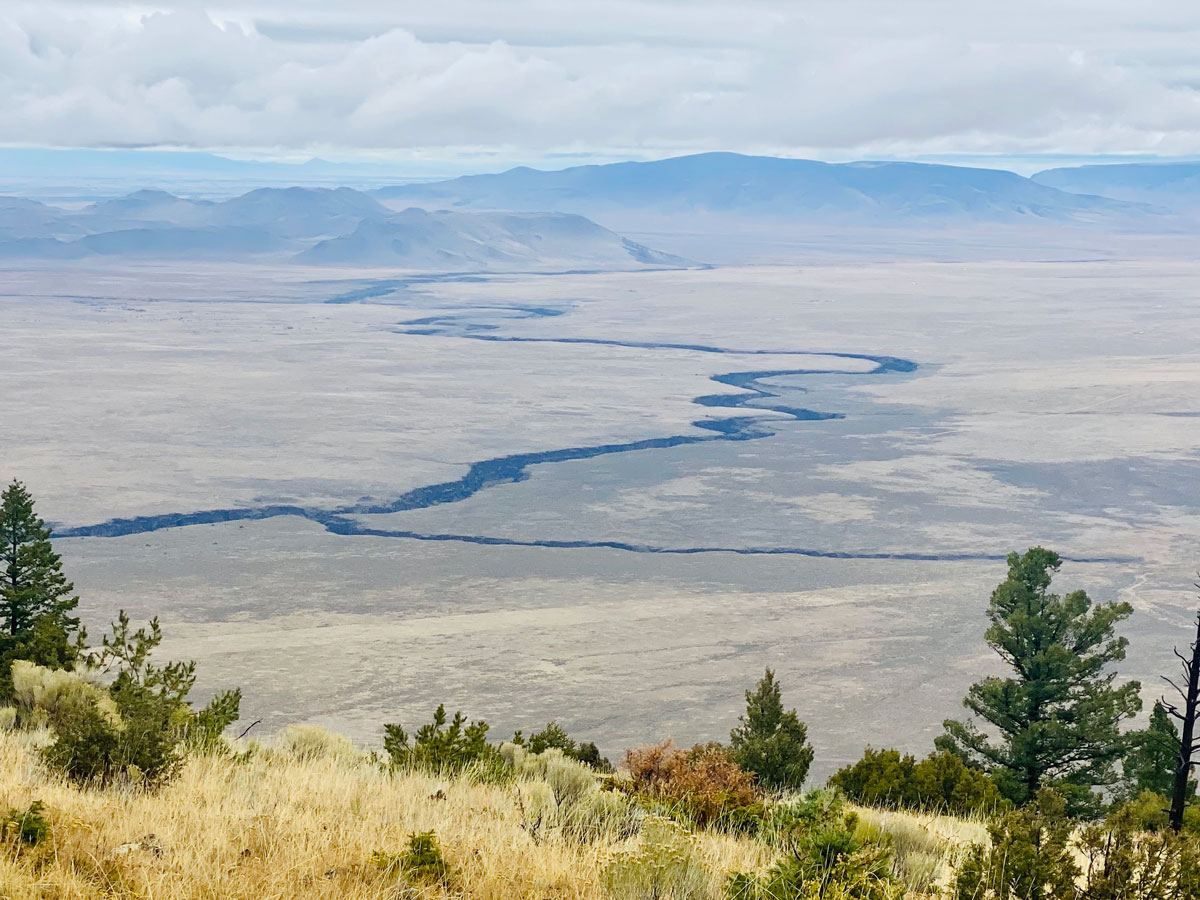
Our downhill scramble offered views that were not visible from the summit, due to cloud cover and foliage. Looking north from the meadow, the deep Rio Grande Gorge and nearby Colorado peaks are in full view. The Gorge appears as a deep crack in the earth’s surface for well over 100 miles. Due to the treacherous nature of Ute, we were on the mountain for about seven hours.
Upon reaching the bottom one experiences a sense of gratitude for finishing, for being the only three folks “up there,” and for the desolate splendor that we call northern New Mexico.
Or as our hiking partner deftly observed: “This is just a weird hike.”